
| Project Home | About the Scans | Browse Gallery | Image Map | Support Data | Resources | Ephemeris |
Featured Image - 04/14/2009
The Rugged Lunar Highlands
This incredible oblique Apollo Metric Mapping Camera photograph (Figure 1; Apollo Metric frame AS16-M-0699) obtained by Ken Mattingly aboard the Apollo 16 CSM Casper in April 1972 shows the central nearside lunar highlands, just south of the Apollo 16 landing site, which is just out of the frame to the top of this photograph. In the center of this picture, you can see the ancient and incredibly degraded crater Descartes.
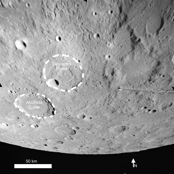
Figure 1. Descartes crater and the central
nearside lunar highlands near the Apollo 16 landing site (Apollo Image AS16-M-0699 [NASA/JSC/Arizona State University]).
We have discussed the differences between the lunar highlands and the lunar maria in a a previous Featured Image. However, the oblique nature of Figure 1 makes the rugged relief of the lunar highlands evident. This is especially obvious when you compare Figure 1 to other oblique Metric photographs of the lunar maria, which are smoother and have fewer large craters. However, despite the rough appearance of this terrain, there are many places where human explorers could safely land, as shown by the highly successful Apollo 16 mission. The upcoming Lunar Reconnaissance Orbiter mission will collect critical data to characterize high-priority sites spread over the entire Moon to enable successful future human lunar exploration.
References:
Apollo
Over the Moon: A View From Orbit (1978) H. Masursky, G. W. Colton,
F. El-Baz, eds. NASA SP-362.
Tweet


|
|
Space Exploration Resources |
|
|