| Project Home | About the Scans | Browse Gallery | Image Map | Support Data | Resources | Ephemeris |
Featured Image (03/17/2009) - Over the Sea of Rains
Some of the Apollo Metric Camera Images were obtained while the Command Module was rolled in order to move the Metric cameras in the Service Module SIM Bay to a non-nadir orientation, increasing the geographic extent of the photographic coverage. We have created a new browsing interface to let users easily view these oblique frames, along with all of the other Apollo Metric images released to date.
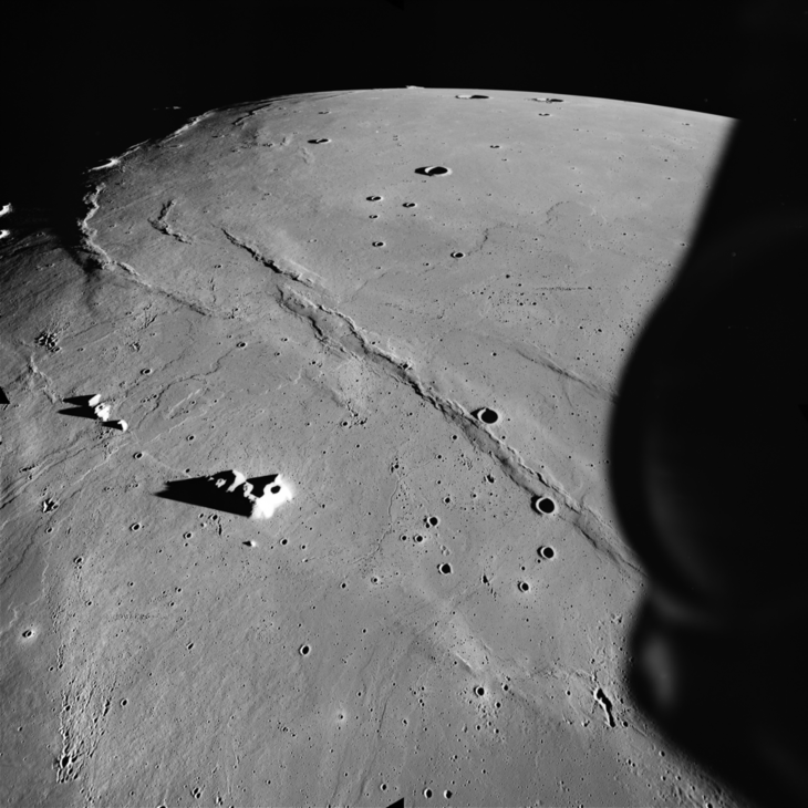
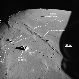
This spectacular oblique picture of the lunar surface shows the view looking almost due north over Mare Imbrium, one of the largest mare on the lunar nearside (Figure 1, AS15-M-1555, collected by Astronaut Al Worden aboard the Apollo 15 CSM Endeavour). We have discussed the complex geology of this region of the Moon in a previous Apollo Featured Image. The oblique nature of this image enhances the dynamic, three-dimensional nature of the lunar surface. In particular, you can see the lobes of individual lava flows and the spectacular relief of the lunar mare ridges (Figure 2). Large (bigger than 100km) craters are relatively rare on this mare surface, but numerous secondary craters dot the landscape. Several small sinuous rilles can also be seen near the bottom of this image.
Figure 1. An oblique view of northern Mare Imbrium. Individual lava
flows, secondary impact craters, sinuous rilles, and mare ridges
can be clearly seen (Apollo Image AS15-M-1555 [NASA/JSC/Arizona State University])
Changes in the angle and the azimuth of the Sun can make it easier (or harder) to derive the topography of the lunar surface through image data. In this case, rolling the Apollo CSM changed the relative angle between the Sun and the camera, which in turn made it much easier for the lunar geoscientists analyzing this image to study the geomorphology of some of the features in this region, especially when combined with other Metric frames from the same region taken at different sun angles.
Figure 2. Annotated version of Figure 1.
The dotted lines show the locations of some of the lava flows, sinuous
rilles, and geographic features visible in the
image (Apollo Image AS15-M-1555 [NASA/JSC/Arizona State University]).
Understanding the topography of a region is important for the selection of lunar landing sites, lunar geoscience exploration traverse planning, and geologic studies of the lunar surface.
As part of its mission to map the Moon to prepare for the permanent return of Americans to the lunar surface, the Lunar Reconnaissance Orbiter Camera [LROC] will be taking repeat pictures with different solar incidence angles and solar azimuths of high-priority sites for possible future human lunar exploration, a technique informally known as photometric stereo. Since the LROC instruments are body-fixed and nadir-pointing, the LRO itself will also be rolled off-nadir to allow LROC to collect high-resolution oblique views of select high-priority sites on the lunar surface (a technique informally known as geometric stereo, commonly used here on Earth for terrestrial applications). These data will then be used by lunar scientists to derive high-resolution (i.e., 3-5 meters/pixel) topographic data for potential sites of human lunar activity to aid in mission planning.
References:
Apollo Over the Moon: A View from Orbit (1978) H. Masursky, G. W. Colton, F. El-baz, eds. NASA SP-362.
Tweet
|
|
Space Exploration Resources |
|
 LPI LPI
|

