
| Project Home | About the Scans | Browse Gallery | Image Map | Support Data | Resources | Ephemeris |
Featured Image - 03/31/2009
Looking Towards the Future Across the Sea of Serenity
This spectacular photograph of Mare Serenitatis was taken during the Apollo 15 mission by Astronaut Al Worden using the Apollo Metric Mapping Camera system (Figure 1, Apollo 15 Metric Mapping Photograph AS15-M-1406).
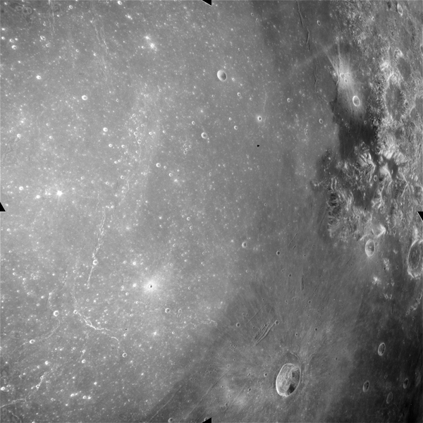
Figure 1. An oblique Apollo Metric Mapping
Photograph looking east across Mare Serenitatis towards the Apollo 17
landing site in the Taurus-Littrow Valley (Apollo Metric frame AS15-M-1406 [NASA/JSC/Arizona State University]).
This is an oblique view looking east over Mare Serenitatis towards the Taurus-Littrow valley where the Apollo 17 mission would land the following year (Figure 2)

Figure 2. Annotated version of Apollo frame
AS15-M-1406. The position of the Taurus-Littrow Regional Dark
Mantling Deposit has been highlighted (Apollo Metric frame AS15-M-1406
[NASA/JSC/Arizona State University]).
We've discussed this region in a previous Apollo Featured Image. However, this oblique view really highlights the amazing geology of the Taurus-Littrow region (Figure 3).
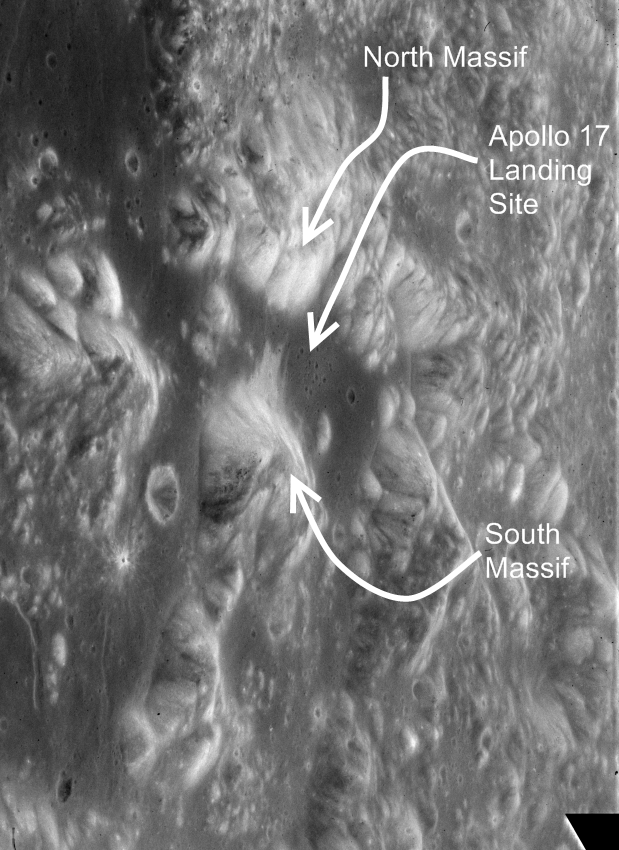
Figure 3. Enlargement of Figure 1 highlighting
some of the major geographical features near the Apollo 17 landing
site (Apollo Image AS15-M-1406 [NASA/JSC/Arizona State University]).
The relief of the North and South massifs is clearly evident. In addition, you can easily see the Regional Dark Mantling Deposit sampled by Schmitt and Cernan in 1972 - it is the dark material in Figures 2 and 3 which subdues and blankets the adjacent terrain. In fact, this photograph was one of numerous Apollo 15 photographs used by NASA mission planners to plan the subsequent Apollo 17 mission, much like the images from the forthcoming Lunar Reconnaissance Orbiter Camera will be used to plan future human lunar exploration.
Tweet

|
|
Space Exploration Resources |
|
|