
| Project Home | About the Scans | Browse Gallery | Image Map | Support Data | Resources | Ephemeris |
Featured Image - 11/27/2007
Taurus-Littrow: the Apollo 17 Landing Site
"As I take man's last step from the surface, back home for some time to come but we believe not too long into the future I'd like to just say what I believe history will record that America's challenge of today has forged man's destiny of tomorrow. And, as we leave the Moon at Taurus-Littrow, we leave as we came and, God willing, as we shall return, with peace and hope for all mankind. Godspeed the crew of Apollo 17."
- Eugene A. Cernan, Apollo 17 Commander. Last man to walk on the moon, December 14, 1972.
This image (ID: AS15-M-0564) was acquired by Apollo 15 during its 22nd orbit around the moon on July 31, 1971 using its Fairchild Mapping (Metric) camera. This region (centered at: 21.8° N, 31.6° E) is near the southeastern edge of the Serenitatis basin (dashed line). The rough textured terrain (covering most of the image) is the remains of the ejected material and displaced bedrock from that catastrophic meteor impact that formed the basin. These mountainous features are the southwestern extent of the Montes Taurus region. The darker and smoother plains in the image are the edges of the massive basaltic flood lavas that fill much of the basin ( Mare Serenitatis). The crater just below the center of the image is Littrow crater. The linear features (generally trending north-south; green arrows) common in the left side of the image are the result of the mare basalts cooling, therefore contracting and producing extensional faulting forming graben structures. The high albedo (light tone) area (A) in the image is ejecta from a relatively recent impact. Note that the older, larger craters are more degraded than the younger, smaller craters
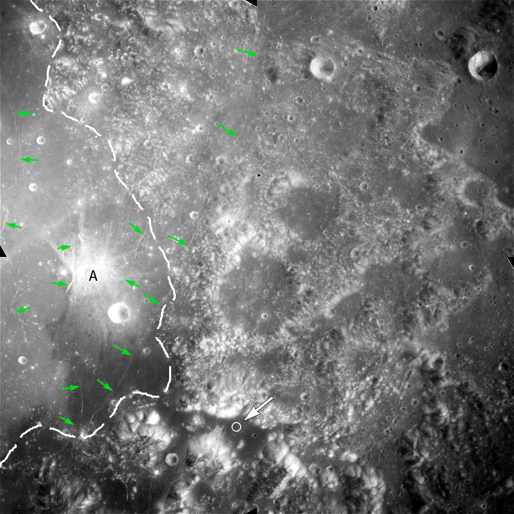
(Apollo Image AS15-M-0564 [NASA/JSC/Arizona State University])
The white arrow pointing to the circle near the bottom of the image is where Apollo 17 astronauts Harrison H. (Jack) Schmitt and Eugene Cernan landed and stepped onto the lunar surface on December 11, 1972 in the Taurus-Littrow valley. A more detailed view of this area is in the figure below. Apollo 17 set many records in the Apollo program. The missions astronauts brought back the largest bulk of lunar samples (110 kg), explored the most territory (30 km traverse), and spent the longest time outside the Lunar Module on extravehicular activities (EVAs; 22 hours and 4 minutes total). This was also the only mission on which a professional geologist, Schmitt, was able to explore the lunar surface as a traditional field geologist, thereby greatly increasing the chance for opportunistic science to take place.

(Portion of Apollo Image AS15-M-0564 [NASA/JSC/Arizona State University])


|
|
Space Exploration Resources |
|
|